If there is an arrow to the left of a person's name, click it to see that person's location in the picture.
|
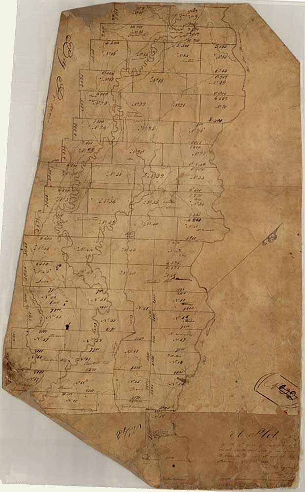
Map that includes League No. 21 in Stephen F. Austin's first
colony that was granted to William C. Carson in 1827 If there is an arrow to the left of a person's name, click it to see that person's location in the picture. |
|
|
| Picture ID: | 255 | |
| Picture Date: | 23 Apr 1831 | |
| Location: | Matagorda County | |
| Picture Description: | Leagues surveyed on the southwest side of the San Bernardo, between it and the Bay Prairie; surveyor, Seth Ingram; map size 36.6 x 22.8; purpose, Austin Colony | |
| Entered into Album: | 8/11/2003 | |